
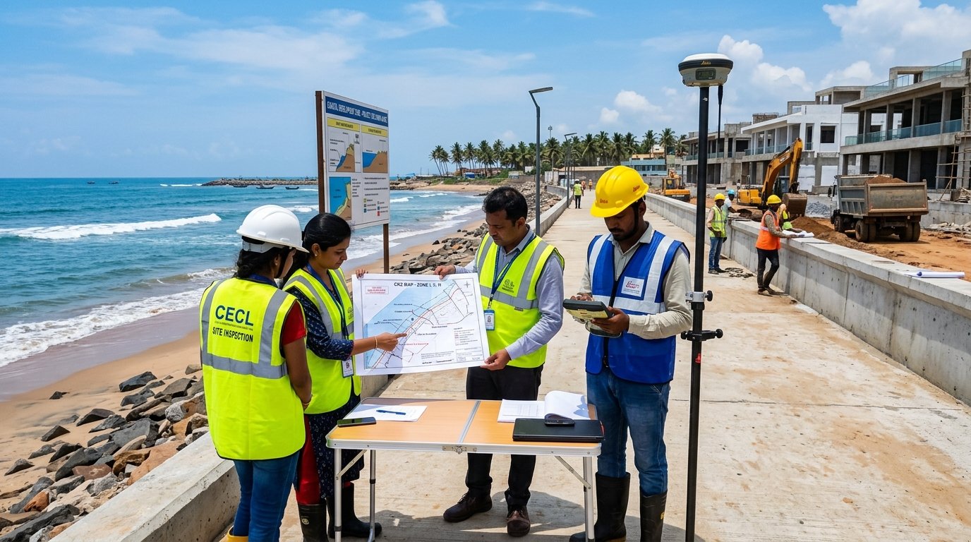
Navigating Coastal Regulation Zone Clearances with Technical Precision
Development activities in coastal areas are strictly regulated under the Coastal Regulation Zone (CRZ) Notification issued by the Ministry of Environment, Forest and Climate Change (MoEFCC) and are subject to the applicable provisions and mandatory approvals of the Coastal Zone Management Authority (CZMA).
Creative Tekno Services & Land Developers Pvt. Ltd. (CTS & LD) provides professional CZMA permission and CRZ clearance advisory and liaison services, assisting clients in determining the applicable CRZ classification, evaluating project viability, preparing compliant engineering submissions, and navigating the multi-stage statutory approval process.
We help clients thoroughly understand the applicable CRZ zoning restrictions, No Development Zones (NDZ), permissible setback regulations, and facilitate the required statutory approval process for eligible residential, commercial, industrial, tourism, and marine infrastructure projects in coastal regions.
Comprehensive CZMA & CRZ Clearance Services
CRZ Zoning Verification
Comprehensive site coordinate mapping against approved Coastal Zone Management Plans (CZMP) to establish exact site boundaries and buffer distances from High Tide Lines (HTL) and Low Tide Lines (LTL).
Identification of CRZ Classification
Precise determination of applicable classification (CRZ-I, CRZ-II, CRZ-III, or CRZ-IV) and assessment of designated No Development Zones (NDZ), ecologically sensitive buffers, and tidal influence zones.
Development Assessment in CRZ
In-depth feasibility assessment of proposed layouts, buildings, tourism resorts, or industrial units against permissible vs prohibited activities under current CRZ Notifications.
Technical Documentation & CRZ Maps
Preparation, superimposition, and coordination of 1:4,000 cadastral CRZ maps through MoEFCC-authorized agencies, Project Information Reports, and environmental mitigation matrices.
CRZ / CZMA Application Filing
Compilation and structured submission of complete statutory application dossiers on State and Central single-window environmental clearance portals.
Authority Coordination & Liaison
Continuous representation, tracking, attending Technical Committee meetings, facilitating site inspections, and following up through final CZMA recommendation and sanction release.
Our CZMA Approval & Liaison Workflow
Site Coordinate Capture & Preliminary CRZ Audit
Capturing high-accuracy DGPS boundary coordinates, examining local revenue survey numbers, and checking baseline alignment with the State Coastal Zone Management Plan (CZMP).
Authorized Agency CRZ Demarcation & Plan Integration
Coordinating with MoEFCC-authorized mapping institutions (e.g. NCSCM, IRS) for official HTL/LTL demarcation and overlaying architectural master plans on 1:4,000 cadastral survey sheets.
Dossier Compilation & CZMA Portal Submission
Preparing Form-I applications, Environmental Management Plans (EMP), disaster management strategies, and uploading certified documents to the State Coastal Zone Management Authority portal.
Technical Committee Review, Site Scrutiny & Order Handover
Assisting proponents in technical presentations before the State Coastal Committee, resolving technical queries, facilitating joint inspections, and obtaining the final CRZ Clearance Order.
Key Regulatory Authorities & Coastal Frameworks
Frequently Asked Questions
Any construction, layout development, foreshore facility, tourism initiative, or infrastructure work located within 500 meters of the High Tide Line (HTL) along the sea coast or within 100 meters/width of tidal water bodies (creeks, backwaters, estuaries) requires mandatory statutory permission from the Coastal Zone Management Authority (CZMA) to verify environmental compliance and legal feasibility.
CRZ-I: Ecologically sensitive areas (mangroves, coral reefs, sand dunes) where construction is strictly restricted.
CRZ-II: Developed urban areas substantially built up up to the shoreline with existing municipal infrastructure.
CRZ-III: Rural or undeveloped coastal areas where No Development Zones (NDZ) and regulated construction norms apply.
CRZ-IV: Water areas from the LTL up to 12 nautical miles and tidal water bodies.
Our experienced team conducts an upfront technical feasibility review, ensuring exact cadastral superimposition, proper documentation compliance, and direct coordination with statutory agencies, minimizing regulatory scrutiny delays and ensuring seamless clearance for eligible projects.